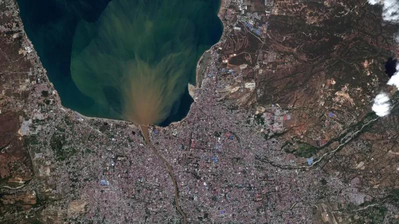
Satellite image of Palu City after the earthquake (2018).
Image source: ©2018 Digital Globe, a Maxar Technologies company
Geographically, Indonesia is an archipelagic country located at the end of the movement of four world plates, Eurasia, Indo-Australia, the Indies, and the Pacific. Such geological and geographical conditions have shaped natural resources and hazards and made Indonesia very prone to natural disasters, such as earthquakes, floods, tsunamis, volcanic eruptions, and landslides.
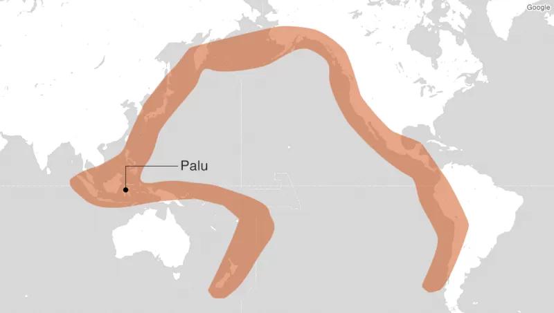
Image source: USGS
The Palu and Donggala disasters (2018) in Sulawesi events add to the series of disaster records in Indonesia. The National Agency for Disaster Countermeasure (BNPB) in 2018 recorded at least 362 earthquakes in Central Sulawesi Province. The strength of the Palu and Donggala earthquakes reached 7.4 on the Richter scale, which resulted in aftershocks in the form of a tsunami along the Talise coast, Palu City, and along the coast in Donggala Regency. The natural disaster was also accompanied by liquefaction, which is a condition that occurs due to earthquake shaking, which presses on the sandy soil causing water from the soil layer to be pushed and flow to the surface.
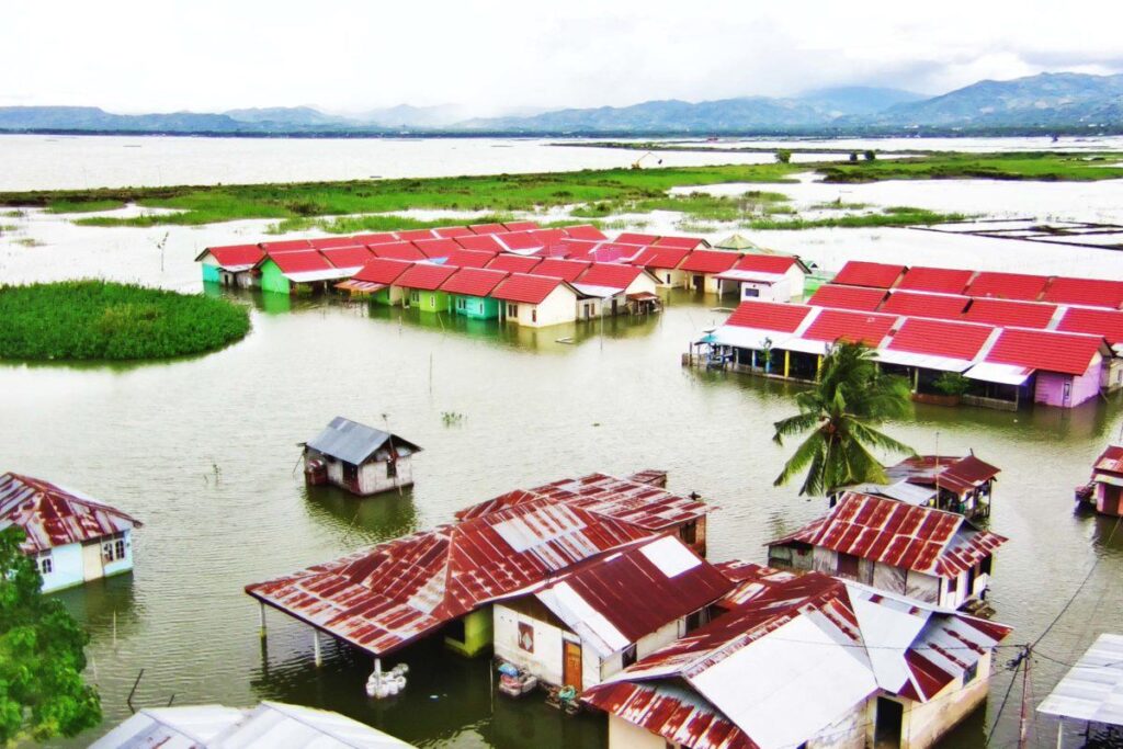
Image source: Sarjan Lahay (Mongabay Indonesia)
Sulawesi has two sides: old volcanic mountains and lowlands, which are partly dominated by swamps. The condition of the Palu and Donggala disasters can be said to be the worst natural disasters in 2018, followed by floods in 2019 and 2020 in South Sulawesi, North Sulawesi, Gorontalo, and Southeast Sulawesi, and then followed by the earthquake in West Sulawesi in 2021 and floods in 2022 in Central Sulawesi. The impacts caused by these natural disasters result in damage and losses grouped into geological hazards, hydrometeorological hazards, biological hazards, technological hazards, and environmental degradation.
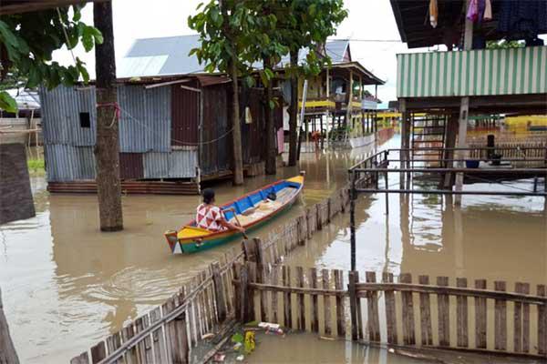
Image source: Junaidi Sudirman (Antara)
Currently, disaster issues are more discussed, but unfortunately, the impact of disasters on biodiversity has not received serious attention, evidenced by the scarcity of research on this subject in Indonesia. Natural disasters are predicted to put pressure on the inland water environment in the next few decades. This change will impact decreasing biodiversity and worsen the ongoing environmental damage. Humans and nature ideally coexist in harmony. This ecological disaster may be triggered by over-exploitation of natural resources and ecological degradation to maximize profits without regard for environmental sustainability or the safety of people's lives in the future.
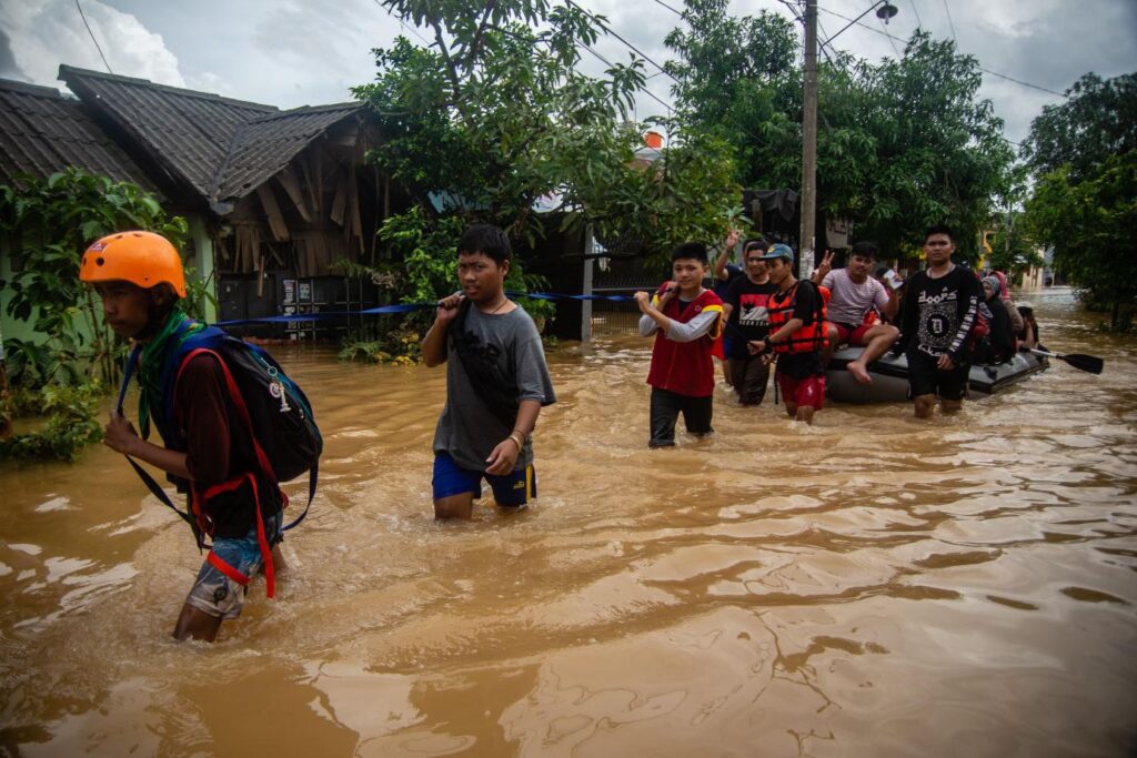
Image source: Iqbal Lubis (Mongabay Indonesia)
These successive disasters impacted all sectors, including the pet trade. The region that became the epicenter of this disaster is renowned as an ornamental fish center. As a result of the disaster, the area was isolated for several days or several months until it recovered. Natural disasters such as floods directly impact the survival of aquatic biotas in Sulawesi, including shrimps and fish. Although it is believed that aquatic organisms can survive better when hit by floods, it is doubtful whether they can survive when they leave their natural habitat. Organisms that live in rivers and lakes have undergone a process of adaptation, and if there is a change, it will undoubtedly impact their survival. If aquatic biota is subjected to extreme environmental changes due to a disaster, such as being relocated from their prior habitat to deep muddy waters, they will undoubtedly be harmed. Even if they do not perish, the shrimp and crabs swept away by the overflowing water will be spread to various areas beyond their native habitat.
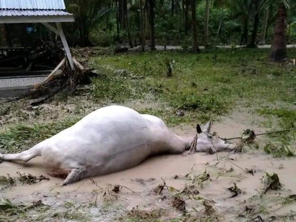
Image source: BPBD Kabupaten Banggai
Opportunities for research and application of Disaster Risk Management Technology are extensive, starting from understanding the characteristics of threats, vulnerabilities, and community capacities. Includes weather prediction, preparedness, and risk communication, so it is necessary to collaborate with all parties. The cooperation in question can be strengthening regulations, institutions, and planning based on Disaster Risk Management under the mandate of Law Number 24 of 2007. In the period of the Industrial Revolution 4.0, the application of RI 4.0 for disaster management decision-making must be made through increasing the usage of the Internet of Things, Big Data, and Artificial Intelligence (AI). So from the things above, it is also necessary to support and synergize from various parties to encourage national disaster research and its impact on aquatic biodiversity, especially in Sulawesi, a disaster-prone area.
For this reason, it is necessary to prepare impact-based forecasting and risk-based warnings towards a nation that is ready for disaster. The Indonesian government needs to improve several things in disaster preparedness: the availability of information and an Early Warning System, international cooperation, and national and local disaster management strategies.
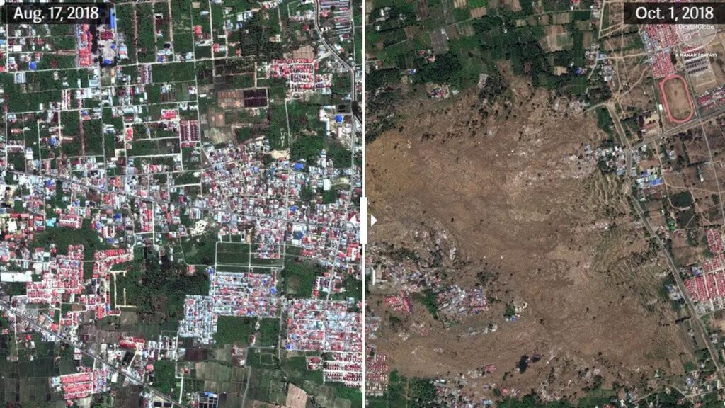
Image source: Planet Labs, Quartz
Surya Gentha Akmal & Jiří Patoka